vrijdag 24 september 2021

They are clearly manipulating the data: M9.5 earthquake in Argentina downgraded to M6.0 before completely disappearing from the maps

They are clearly manipulating the data: M9.5 earthquake in Argentina downgraded to M6.0 before completely disappearing from the maps

        M9.5 earthquake downgraded to M6.0 and then M4.7 earthquake by USGS


A powerful M9.5 earthquake hit La Rioja, Argentina at a depth of 649km (403 miles) on September 23, 2021, around 12:18 UTC (or 9:18 local time). At least this is what everyone thought at the beginning…


Just a few minutes later, what would have been one of the most powerful earthquake ever measured on Earth, was deleted by the Chilean Geological Survey:

                                    M9.5 earthquake deleted on September 23, 2021

But wait, the saga is not finished yet.


5 minutes later, another alert from Volcano Discovery says the exact same quake is now a M6.0:

M9.5 earthquake downgraded to M6.0 earthquake in Argentina on September 23, 2021

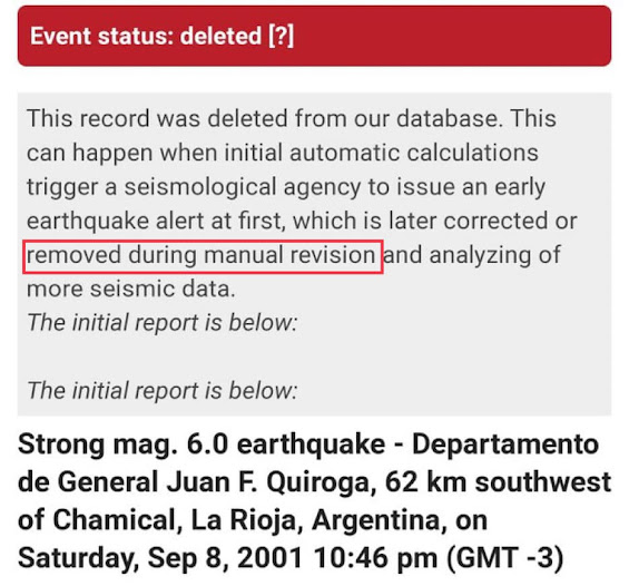
Again, this M6.0 quake was deleted, or better said ‘manually revised’ by seismologists:

Now if you look at the USGS earthquake map and you zoom on Argentina, there are currently no earthquakes shown… Not a single one!


So what the heck guys!?! Are you playing with our nerves? Are you manipulating the data?